The Arctic is undergoing the most rapid changes in the climate system worldwide, demonstrated by the thinning and reduction of sea ice, the melting of ice sheets and glaciers, thawing of permafrost, and an increased possibility for extreme weather events and other hazards. While the role of these Arctic changes in increasing risks of extreme weather events remains strongly debated, these interlinked processes are expected to increase the chance of natural hazards connected to unstable sea ice conditions and unexpected occurrences of icebergs. Such rapid and hard to predict changes pose a significant risk for shipping activities in this region, whether it be cargo, fisheries or tourism. Therefore, improved access to new and customised data products from innovative combinations of available in-situ measurements, remote sensing imagery and forecasting models is critical to further development of safe and sustainable Arctic shipping.
The overall objective of the Digital Arctic Shipping project is to develop a suite of data products in collaboration with Arctic shipping companies and local authorities and to demonstrate the use of these products on vessels traveling in ice infested areas. This includes using drone mounted sensors custom-built for Arctic operations, in combination with near real-time data from satellites, and automatic identification of ice dynamics patterns (divergence, convergence). Examples of products include maps of ice types, ridges, leads and motion, which are all essential parameters for navigation in sea ice. Products will be transmitted to vessels using the best available satellite communication networks and used together with data collected on board (e.g. Automated Weather Stations (AWS)) and data supplied by other actors (e.g. Automatic Identification System (AIS)).
'0 934/2
Arctic sea ice thinning opens for new shipping routes between Asia, Europe and the US (Figure 1). COSCO, the world’s largest shipping company, recently stated that Arctic routes provide a large business opportunity of reduced transportation costs from Asia to Europe (Struzik, 2016). However, in the same paper, concern was raised on potential severe consequences on the marine environment resulting from increased Arctic and that more and better data products were needed to make Arctic shipping safe. Today, the Arctic Shipping Best Practice Information Forum of PAME reinforces the emphasis on providing timely access to quality data to ensure safe operations in the Arctic.
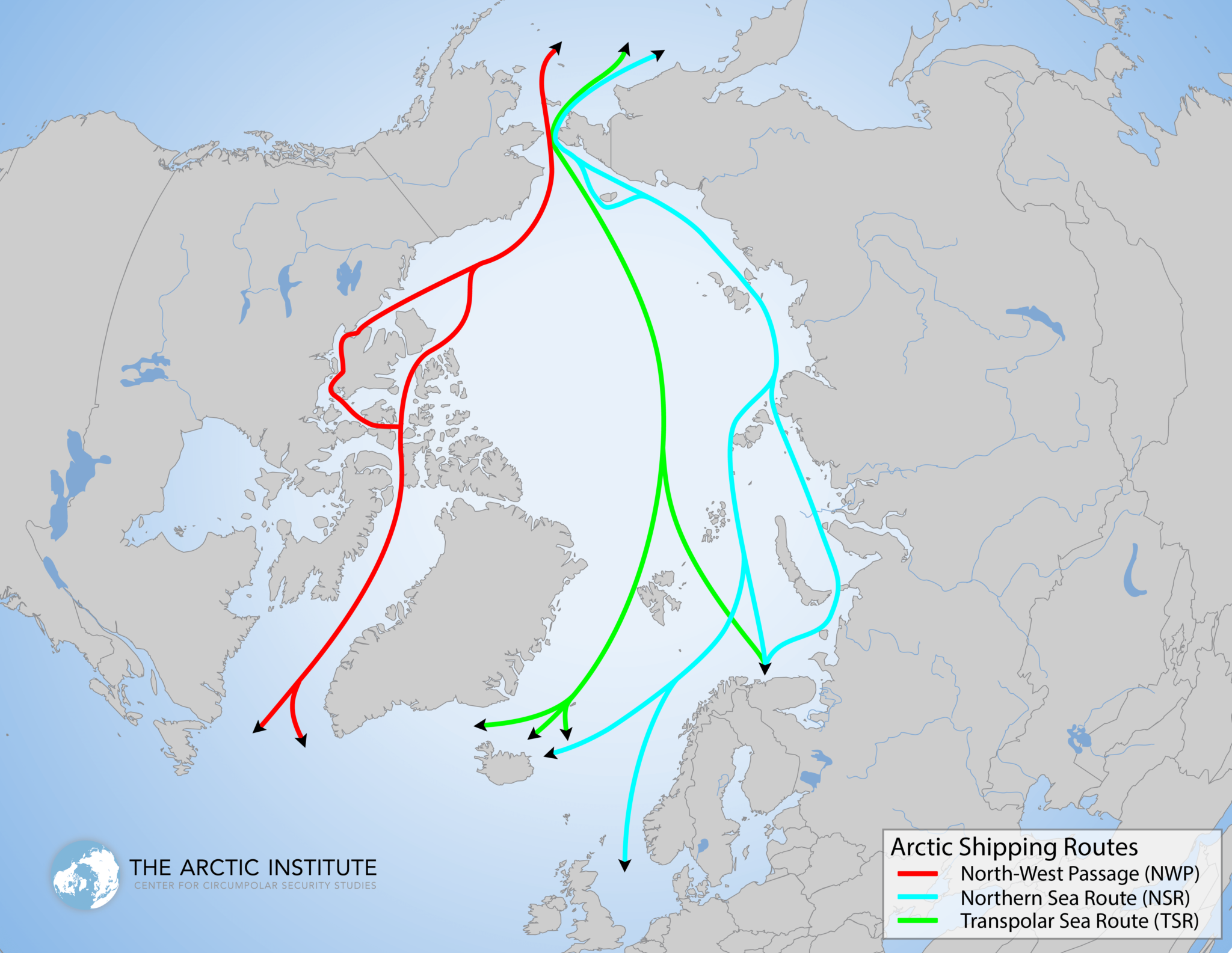 |
Figure 1: Arctic sailing routes opening as a result of climate change (Source: The Arctic Institute)
The Arctic ocean is poorly covered by in situ observations, as these are typically collected as part of scientific cruises, and not by operational services. While medium-coarse resolution satellite products and model projections are available on a regular basis, such products are not tailored for Arctic shipping. Thus, there is a need to improve both the amount and the suitability of data products available. This can only be achieved by adopting novel ICT methodologies and frameworks for efficient data collection and organisation, analysis and visualisation. Better algorithms are needed to extract key sea ice parameters from the vast amounts of data available from satellite sensors and simulation models. This includes use of high-resolution images from drones with sensors custom-built for Arctic operations, in combination with near-real time (NRT) data from satellites, providing data on ice dynamics patterns (divergence, convergence).