Drone technologies
Digital Arctic Shipping is deploying new drone-sensor system configurations during field experiments in different areas of the Arctic Ocean. The chosen drone systems (Figure 1) have been successfully used in earlier Arctic field experiments (e.g. CAATEX 2019, OPV19, SIOS-Infranor 2019, RESICE 2018). Experiences from the first field experiments in 2020 and 2021 will be used to enhance the drone systems and imaging sensors. This will lead to a more versatile and robust system for capturing very high resolution images of the sea ice situation surrounding a vessel during the second field experiment in 2022.
 |
 |
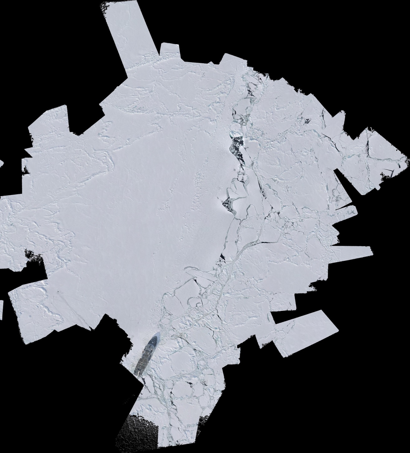 |
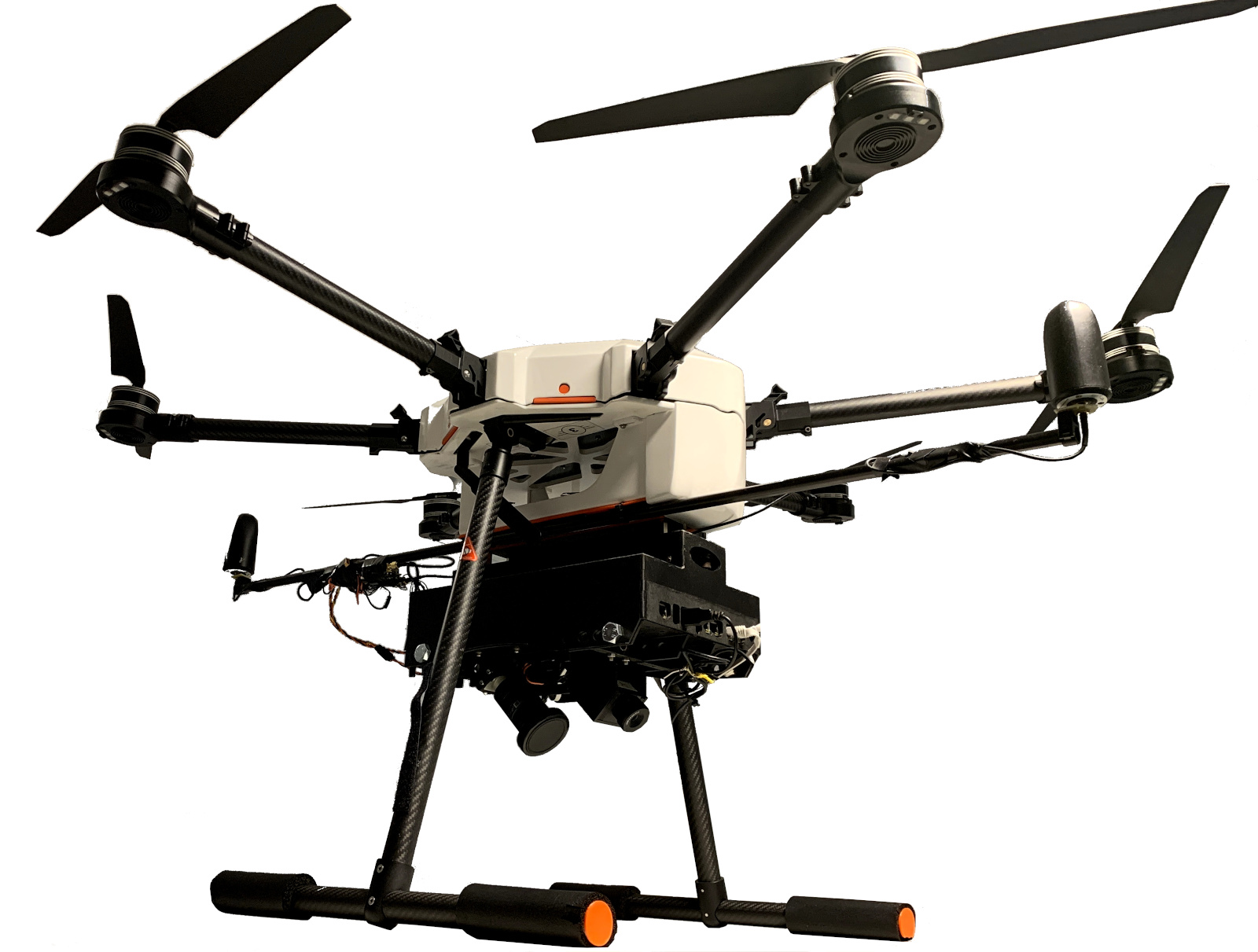
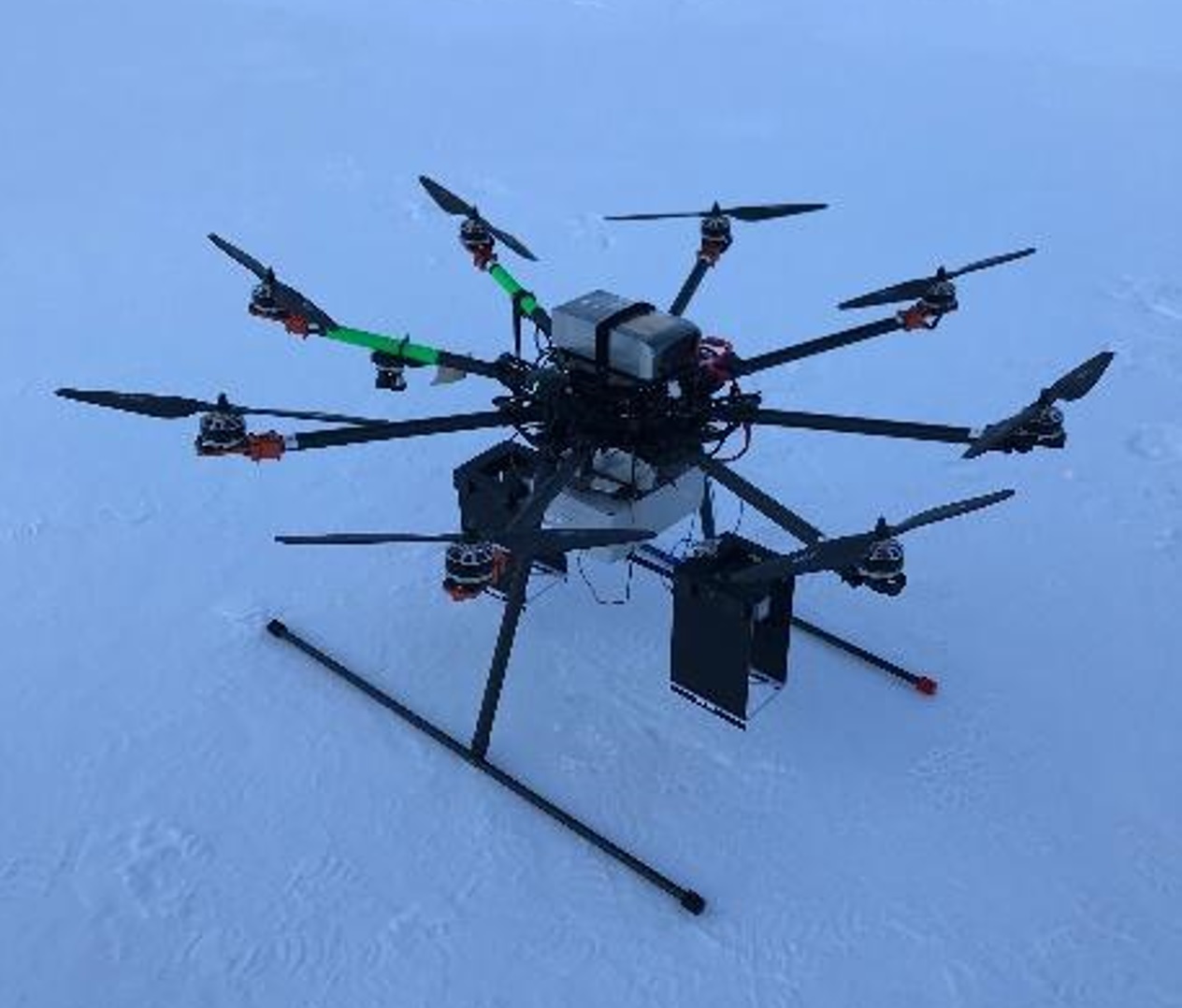
Figure 1: HEIFU drone with Maritime Robotics' sensor pod, Kraken Octocopter drone with radar sensor, and example drone mosaic with KV Svalbard.
Maritime Robotics has several uncrewed aerial systems (UAS) at their disposal, which include their Falk UAS system (Figure 2), as well as multicopters from other suppliers where MR focuses on payload integration. For the Digital Arctic Shipping project, Maritime Robotics is planning to operate with a new sensor pod that includes both EO and IR cameras. This can be flown from a multicopter, such as the DJI M600 or the BeyondVision HEIFU drones (Figure 1). These drones can carry ca. 7.5-10 kg payloads, and fly at speeds of up to ca. 60 km/h in zero wind conditions. Both drones are expected to be able to fly for about 20 minutes with the payload system. Several flights can be done to collect data over ice. The data collected will be further processed using machine learning algorithms, including the expertise from Bergen Robotics.
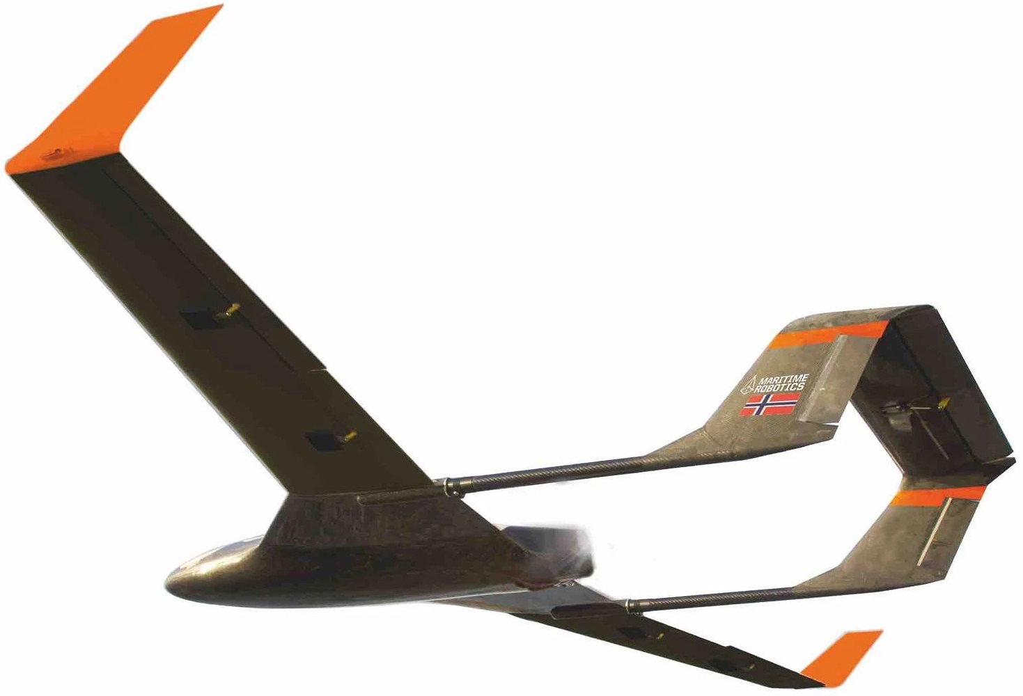 |
Figure 2: Falk Unmanned Aircraft System (UAS) developed by Maritime Robotics.
Examples of drone imagery
The Norwegian Research Centre (NORCE) participated in the Coordinated Arctic Acoustic Thermometry Experiment (CAATEX) cruise with the Norwegian coast guard vessel KV Svalbard to the North Pole in the period August 14 to September 9, 2019. This cruise was coordinated by the Nansen Environmental and Remote Sensing Center (NERSC), and during the cruise NORCE operated an imaging radar system and several different unmanned aerial vehicle (UAV) platforms. Among others, NORCE operated a fixed-wing unmanned aircraft system (UAS), which was used to collect high-precision optical imagery. Figures 3 and 4 show examples of drone imagery collected during the CAATEX 2019 cruise.
 |
Figure 3: Drone image from 21 August 2019 (source: Tom Rune Lauknes, NORCE).
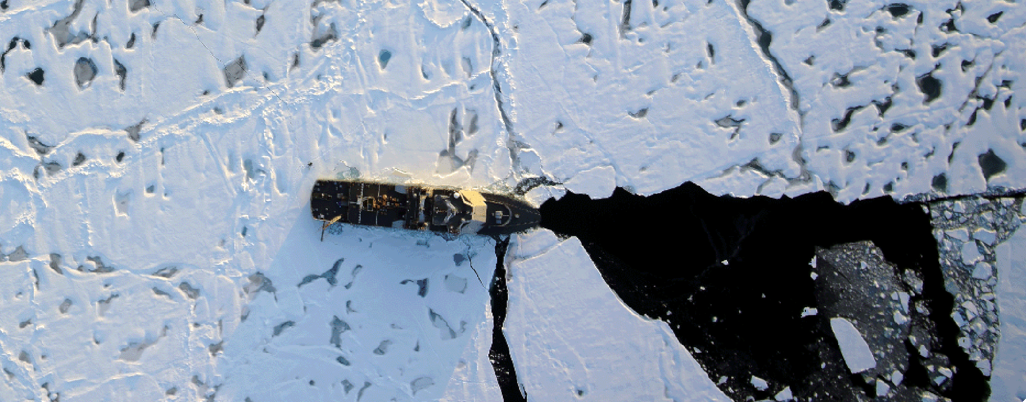 |
Figure 4: Drone image from 31 August 2019 (source: Tom Rune Lauknes, NORCE).